Lôn Las Cymru Trip: Bath to Abergavenny
Early this year, while planning a ride up to Ironbridge, I came across National Cycle Network’s route 8, aka Lôn Las Cymru. This is Wales’ 250-mile coast-to-coast route from Cardiff Bay in the south to Holyhead in the north, and is described as ‘one of the toughest long-distance routes on the National Cycle Network’. According to cycle.travel:
This 250-mile route traverses the country’s most mountainous countryside, from the Brecon Beacons to Snowdonia. And if that sounds spectacular, it is. The scenery is among the finest of any cycle route.
I was rather daunted by how challenging it sounded, so planned to ride just the bottom half from Rhayader on my return journey instead. Unfortunately, when I got to Rhayader I had to bail out of my trip due to knee pain. It turns out knees don’t like suddenly jumping from 10-mile days through winter to 165 miles in 2 days... I was gutted, especially since the landscape around me had been getting steadily more and more beautiful, and knew I had to return one day.

In summer that day came. I had a couple of weeks to spend cycling, and the decision wasn’t a hard one! I was worried that the knee pain would recur, so trained better and prepared myself to take it easy, do low mileage and push up hills if necessary.
My plan was to head from Bath up the alternate southern route, NCN-42, through Abergavenny and the Black Mountains, and join route 8 near Hay-on-Wye. After Holyhead I would return south - by train if time was running short - to cover the southern section down to Cardiff.
The first day didn’t start well. I was under-prepared, late leaving, and cold and wet before I was 10 miles from home. My optimistic “If I don’t put my coat on, maybe the rain will get bored and go away?” thinking did not manifest the desired results. After the now-mundane trek around the familiar Bristol area, I met up with a friend to borrow his GoPro then headed for the old Severn Bridge, where 35 mph crosswinds made for a terrifying but exhilarating crossing!
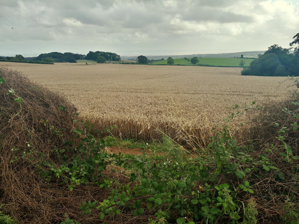
Grain field and views of the Severn valley
A few miles later I discovered my pump was missing. I think I’d attached it poorly to the bike, and it must have been jolted off somewhere. Theoretically this is fine as I run tubeless, but I carry a backup tube just in case and felt exposed without a pump. Hoping it had come off on a recent downhill, I backtracked for 3 miles searching the roadside, but it did not want to be found. I got back on my way and made a conscious effort to tune into my body, searching for a cadence and posture that felt efficient and comfortable. I generally find it takes me a day or two at the start of a tour to find my rhythm.
After a brief stop for a pint in Usk I detoured for my campsite. I’d booked one for the first night, for little reason other than it sounded like a lovely place, perched on the side of Blorenge overlooking Abergavenny. I followed the Monmouthshire and Brecon canal towpath (NCN-49) for a quiet 5 miles, dodging the occasional tree dropped by recent storms, but enjoying the view and looking forward to food and a rest. I was pretty tired and uncomfortable, and the final half mile straight up a steep 350-foot climb in pouring rain really finished me off. As dry clothes, a cup of tea, and boil-in-the-bag curry worked their magic on me though, the weather cleared and I was rewarded with sunset views over the Usk valley. Happy.

Joining the Monmouthshire and Brecon Canal towpath